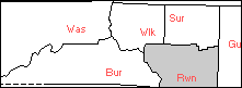
ca 1777
of Old Surry Co, NC
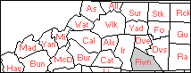
Old Rowan ca1869
ca 1777 | Combs &c. Land of Old Surry Co, NC | Old Rowan ca1869 |
|---|
Last Modified
You Are Our Visitor.
Please Email Additions/Correction to The Combs Research List
Surry Co NC was established eff. 01 Apr 1771 from Rowan Co NC, and in 1777, Wilkes was created from Surry. Because Surry and Wilkes Co NC traded land and the county line was sometimes unclear to all, including the tax collectors and surveyors (sometimes including those in Virginia), this report includes land that was originally part of "Old Surry" (including present-day Alleghany, Ashe, Wilkes, Yadkin, Rutherford, Stokes, etc.). See Also Bibliography for this Report
| North Side of Yadkin River | South Side of Yadkin River |
| Unidentified | Unidentified |
| Camp Creek of the Mitchell River | Pipe's Creek |
| Mitchell River | Seven Islands/York's Creek |
| Cody's Creek | Round Hill |
| Fisher's River | Tumbling Falls |
| McClain's Ford of the Yadkin | |
| West Double Creek | |
| Garrison Creek (Wilkes -not found) | |
| County Line | |
| Hunting Creek | |
17 Nov 1785 (Surry WB 2:102) 17 Nov 1785. Inv. of Est. of Mason Combs decd incl. 400 a. & notes against Nathan ALLEN, John RIPS, Jesse FRANKLIN, Wm. Combs, Jno. Combs. Ret. by John Combs. Rec. Nov. Ct. 1785.
Notes: Not certain yet which land of Mason Combs the above was, possibly the following:
09 Aug 1784 (Surry WB 2:33a) John Combs, for 150 pds., to Mason Combs, Sr., 'the land on which I live, mill, livestock, personalty. 9 Aug 1784. Wit: William COOK, George HUSTON, Rec. Aug. Ct. 1784. (Surry Wills, Jo White Linn)
08 Aug 1787 (Surry NC DBC:436) 8/8/1787 NC Grant to Francis COOMES, 200 acres, Round Hill, South side of Yadkin River
06 Aug 1796 (Surry DBF:332) 6 Aug 1796. Francis COOMER [sic] to John FARMER, £100, 200 acres waters Yadkin. Wits: Nathan FARMER and Jacob GREEN. s/Francis [X] COOMER.
Notes: The above is Francis & Charity WOOD Combs. Land not yet located… See Also their daughter, Lydia, and husband, Amos SCRITCHFIELD of Fisher's Creek, N Side of Yadkin.
23 Jul 1773 (Surry Co. NC Land Entry #307) Mason Combs, Senr., enters 250 A in Surry on South [sic] side of the Yadkin River against Tumlin Falls, including his improvement.
12 Apr 1788 (Surry NC DBE:232) William T. LEWIS to Joel LEWIS, 100 lbs., 250 Acres South Side Yadkin River against Tumbling Falls. s/Wm. T. LEWIS. Wits: William COOK, Jr., Thomas JOHNSON, and J. M. LEWIS.
15 Jun 1792 (Surry NC DBE:232) Joel LEWIS to James DEFREES, 250 lbs., 250 Acres South Side Yadkin River against Tumbling Falls. s/Joel LEWIS. Wits: John HUNT, Wm. T. LEWIS and J. FROHOCK.
24 Oct 1782 (Surry DBB:238-9) NC Grant Joseph WOODRIFF 200 A South side Yadkin River, agreed line with Benjamin CHABEK(?)
11 May 1784 (Surry DBC:59-60) Joseph WOODRUFF to John ALLIN 50 pds. 400 ac. S side Yadkin River; mentioned in two deeds dated 24 Oct 1782. s/Joseph X WOODRUFF. Wits: Alexander HAWKINS, John BOHANON, Aaron MOOR
05 Feb 1788 (Surry NC DBD:257) Nathaniel WOODRIFF to William COOK, 200 pds., 200 A South side Yadkin River below Joseph WOODRUFF (now John ALLEN). Witnesses W(illiam) MEREDITH, David RIGGS and Jabez HARVIS [JARVIS?] s/Nathaniel WOODRUFF
06 Aug 1791 (Surry NC DBE:143) William COOK, guardian to orphans of William RIDGE, deceased to William and Thomas RIDGE, two of said orphans, 150pds., 200 A South side Yadkin River opposite mouth of Fishers River; land formerly belonging to Nathaniel WOODRIFF. Acknowledged. s/William COOK.
Notes: This land directly across the Yadkin River from land entered by Richard PACE 1791 (Surry NC Historical Map). On 20 Dec 1791, Edmond PACE recorded 200 acres described as on Fishers River adjoining Richmond [sic] PACE including his own improvement. (Surry NC DBE:72) The Surry NC Historical map also show Edmund PACE with a 1791 entry on Davenport Creek of the Fish River. near Jabez JARVIS and David THOMASON [THOMPSON]. The land is just north of the mouth of the River (into the Yadkin), thus very close to the above land. See Yadkin River, North Side: Fishers River
24 Oct 1782 (Surry NC DBB:196-7) NC Grant John PIPES 200 acs S Side Yadkin River mouth Pipes Creek adj. John PARKS.
3 Nov 1784 (Surry NC DBC:234) . NC Grant John PARKS 200 acs S side Yadkin River, mouth Pipes Creek; agreed line bet sd PARKS & John PIPES.
25 Nov 1783 (Surry NC DBC:453-4) John PIPES, Sr. to Peter DOWNEY of Guilford NC, 100 pds. 198 A mouth Pipes Creek adj. Humphrey COCHRAM & John PARKS.
01 Dec 1791(Surry NC DBE:175) 1 Dec. 1791, Peter (X) DOWNEY to William COOK. Junr. L200. 140 A on Pipes Creek on the South side of Yadkin River to a place agreed upon by John PIPES the elder and Humphrey COCKERHAM [sic] between the Yadkin River and Pipes Creek in said PIPE'S original survey adj John PARKS including the plantation where William COOK. Junr. now lives on and his river plantation. Wits: James DOWNEY. Wm. T. LEWIS. William COOK, Senr.
03 Nov 1784 (Surry NC DBC:234) 3 Nov 1784. NC Grant John PARKS 200 acs S side Yadkin River, mouth Pipes Creek; agreed line bet sd PARKS & John PIPES.
24 Dec 1792 (Surry Co NC DBE:70) NC Grant. William COOK. 500 acres South side Yadkin River adjoining CARTER and CRITCHFIELD.
10 Jul 1782 - Feb 1783 (Surry NC WB 2:8) John COOK of Charlotte Co., Va., to father Wm. COOK of Surry, power of attorney for 464 a. on South side of Yadkin River entered by me to be sold to John BREWIS. Wit: Benj. BURCH, Wm. W. COOK, John Combs. Prvd by BURCH. Rec. Feb Ct. 1783.
09 Feb 1784 (Surry NC DBB288) William COOK by authority given him by John COOK [10 Jul 1782], to Samuel GREENWOOD 150 pds 461 A S side Yadkin River above Seven Islands; crosing Yorks Creed [sic]; agreed line with Nathan BREWER & Benjamin KEELING
24 Oct 1782 (Surry DBB:196) NC Grant. John HURT (no acreage) S Side Yadkin River, adj. Nicholas COOK and a small Island.
24 Oct 1782 (Surry NC DBB:214) NC Grant Nicholas COOK 100 A both sides Yadkin River adj. Olive ROBERTS.
19 Feb 1785 (Surry DBC:228-9) William MEREDITH, Esq. Sheriff to William T. LEWIS (land lost by Olive ROBERTS (male)); judgment by Jos. WILLIAMS & Robert LANIER; 200 A S side Yadkin R; agreed line bet Olive ROBERTS & Nicholas COOK. s/W. MEREDITH, sheriff. No Wits.
02 Sep 1791 (Surry DB E:213) William T. LEWIS to Dugal McMIKLE, 100 pds. 80 A South side Yadkin R, part 200 A granted Olive ROBERTS, laid off by H. SPEER, County surveyor. s/Wm. T. LEWIS. Wits: Joel LEWIS, Aaron MOSER and James JANE (JAYNE).
10 Oct 1791 (Surry DB E:227) William T. LEWIS to William COCKERHAM, 100 pds. 120 A back line formerly State granted to Oliver [sic] ROBERTS. 200 A Yadkin R adj. Dugal McMICKLE. s/Wm. T. LEWIS. Wits: James DOWNEY, State* COOK, and Obediah MARTIN
*probably Stage COOK.
20 Jan 1787 (Surry Co NC DBE:244) John ALLEN, Junr. to Amos SCRITCHFIELD, 25 lbs., 100 A. waters Fishers River adj. plantation where said ALLEN now lives. s/ John (X) ALLEN. Wits: William COOK, Ben BURCH, William MEREDITH and John CRITCHFIELD.
10 Feb 1793 (Surry Co NC DBE:244) Amos SCRITCHFIELD of Spartanburg County, South Carolina to Sherod BROCK, 20 lbs., 100 Acres waters Fishers River adjoining land where John ALLEN, Jr. now lives. s/Amos SCRITCHFIELD. Wits: William MEREDITH, Rezia JARVIS, and John SHORE.
31 Oct 1795 (Surry NC DBF:297) Sherod BROCK to David TOMASON, 45 pds, 100 A waters Fishers River adj. where Peter HAMBLEN now lives on waggon road. Wits: Peter (X) HAMBLIN, William MEREDITH & Rezia JARVIS. s/Sherod (X) BROCK & Sary BROCK.
06 Feb 1793 (Surry Co NC DBE:241) John ALLEN to Peter HAMLEN, 50 lbs. 100, A, the plantation where John ALLEN has lately lived, East Side Fishers River where HOWARDS Road crosses said river adjoining said ALLEN to wagon road adjoining John RICHARDS. s/John (X) ALLEN and Elenor (X) ALLEN. Wits: David BRAY, William BRAY.
13 Jan 1794 (Surry DB John & Ellinor ALLEN to David THOMASON, L100, 100 A Fishers River adj. Yadkin River & Peter HAMLIN. Wits: Thomas HAMLIN & Sherwood (X) BROCK. s/John (X) ALLEN and Ellenor (X) ALLEN.
Notes: Amos CRITCHFIELD (a.k.a. SCRITCHFIELD, CRUTCHFIELD) m 27 Aug 1783 in Surry NC, Lydia Combs, d/o Francis & Charity WOOD Combs. Abner ROSE and David THOMASON wit. the 1802 (dated) will of Peter HAMBLEN. Is the above David THOMPSON the same as or kin to David THOMPSON who m Nancy CODY (d/o William & Sinai STACY Cody of Surry NC) in Aug 1784 in Montgomery Co VA? See White Co TN for Abner ROSE, Pierce CODEY Rezia JARVIS, and William RIDGE (s/o William & Winnifred Combs Ridge, Sr., gs/o Mason Combs, Sr.)
1780 (Surry NC Land Entry #??) John Combs, land on West Double Creek. (Surry Co, NC Genealogy & Historical Society Historical Map & var. deed and will books, (USGINS Copeland Map, Surry NC, Latitude: 361711N, Longitude: 0803759W)).
03 Apr 1780 (Surry NC DBA:357) 3 Apr 1780. NC Grant Reuben DODSON 300 ac Double Creek adj. Matthew MOORE, mouth Double Creek, Amos EVANS, crossing Mountain Creek, incl. plantation where M. HORTON, the chairmaker, lives.
13 Oct 1783 (Surry DBB:328) NC Grant Amost EVANS 150 A Double Creek.
14 May 1782 (Surry NC DBB:178) William WEBB & wf Martha to Daniel HUTCHERSON, Halifax Co, VA. 300 pds. Va. Money 640 acs mouth Mountain Branch. s/William WEBB. Wits: Reuben DODSON, John FARMER, John SHELTON.
1784 (Surry Land Entry? Deed? Mention?) Mason Combs on West Double Creek. (Surry Co NC Historical Map)
Note: another record, not known what type, mentions Combs Mill in 1784, and the Surry Co NC Historical Map has placed it adj. to Mason Combs of West Double Creek. The record may be the 09 Aug 1784 deed from John Combs to Mason Combs, Sr., in which case more searching needed to determine why SHM researchers determined the land was that of John of West Double Creek rather than John of 1782 McClain's Ford:
03 Nov 1784 (Surry DBC:25) . NC Grant. Richard HORN, 200 A N side Yadkin River below mouth Double Creek. (Surry County, North Carolina Abstracts, Deed Books A, B, and C (1770-1788), Mrs. W.O. Absher, SHP, Easley, SC, 1981)
09 Nov 1787 (Surry DBC:362) NC Grant Richard HORN 320 A N side Yadkin River mouth of Double Creek (Surry County, North Carolina Abstracts, Deed Books A, B, and C (1770-1788), Mrs. W.O. Absher, SHP, Easley, SC, 1981)
09 Nov 1787 (Surry DBC:362) 9 Nov 1787. NC Grant Richard HORN 320 A adj. John HANKINS. (Surry County, North Carolina Abstracts, Deed Books A, B, and C (1770-1788), Mrs. W.O. Absher, SHP, Easley, SC, 1981)
08 Sep 1788 (Surry DBD:119) John HARVEY, Jr. to John HARVEY, Senr. 60 pds. 200 A. exclusive 2 Acres for use Meeting House on Salem Road adj. CALCLEAZIER. s/John HARVEY, Jr. Wits: William HARVEY and Clabourn (X) Gentry. Note: Historical map shows on "Dan River a.k.a. Town Fork a.k.a. Main Road, just above where Double Creek branches into East and West Double.
08 Feb 1788 (Surry DBD:120) John HARVEY, Jr. to John HARVEY, Senr. 65 pds. 90 A. Double Creek adj. BLACK. Ack. S/John HARVEY, Jr.exclusive 2 Acres for use Meeting House on Salem Road adj. CALCLEAZIER. s/John HARVEY, Jr. Wits: William HARVEY and Clabourn (X) Gentry. Note: Historical map shows on "Dan River a.k.a. Town Fork a.k.a. Main Road, just above where Double Creek branches into East and West Double.
06 Nov 1789 (Surry DBD:126) John HARVEY and wife, Mary, to Joseph HALL, 100 pds. 116 A. Double Creek, waters Yadkin River adj. WHITAKER part 206 A State Grant to HARVEY. s/John HARVEY & Mary (X) HARVEY. Wits: William THORNTON, Jacob BLACK.
Notes: This is the earliest record located for a John Combs in Surry Co NC (other than Tory Depositions). Not known which John Combs, nor which Mason Combs, but most probably Mason Combs, Sr. and his son, John Combs, Sr.? Other early entries/deeds/mentions on Double Creek (splits into east and west) Abraham HOWARD (Tory) & Richard HORN, also in 1784; James OLIVER & William HOLAMAN in 1787; William HOWARD in 1789; and Obediah MARTIN in 1794. The land is located in now-south central Surry Co NC with West Double Creek feeding into the Yadkin River. See Also the 17 Feb 1797 Surry Co NC marriage of William RIDGE, Jr. to Sarah HORN, d of Richard HORN);. Not clear on Reuben DODSON, but: (1) Thomas DODSON of Halifax Co, VA was f/o Jesse DODSON who m 1793, Halifax Co VA, Judah/Judith Combs, d/o George & Phoebe Combs of Amelia > Lunenburg > Halifax Co VA > Hawkins/Grainger > White TN - and in the latter County are found William & Sarah HORN Ridge, Jr. (s/o Winnifred Combs Ridge Allin) and Martin & Sarah Combs Johnson and various CODYS as well as various other associated families from Surry NC. Thomas DODSON left Halifax VA for Hawkins Co TN where he and Rev. Thomas MURRELL (step-father of Martin JOHNSON) are both Baptist Preachers, and found together in church minutes, and Martin & Sarah Combs Johnson live on Dodson's Creek of the Holston River (land earlier owned by Thomas' cousin, Raleigh DODSON). Thomas DODSON'S real property disbursements included two daughters and one son who m JOHNSONS. His dau Winnifred DODSON m William JOHNSTON, and daus. Alcy and Susannah m, respectively, Stephen & James JOHNSON. The latter two JOHNSONS are believed to be brothers, and unrelated to William JOHNSTON. Stephen & James JOHNSON'S brother, Thomas JOHNSON, m Barbara HUTCHESON (d/o David), 12 Jul 1786 Halifax Co VA, and their sister, Elizabeth JOHNSON, m Daniel HUTCHESON, s/o David HUTCHESON of Halifax Co VA.
See Also Henry HAND and John Combs herein. See Also Henry HAND and Charles DODSON in records of Wilkes Co NC (1782). Also note John FARMER above and John & Nathan FARMER with Francis Combs of Round Hill in 1796. Reminder: one of Mason Combs, Sr.'s older sisters was named Judith (for what it's worth).
17 Sep 1778 Surry Co, NC Land Entry. William T. LEWIS enters 250 acres of land lying on the north side of the Yadkin River and bounded by Mace [Mason] Combs [Sr] & Henry HAND including William RIG'S [RIDGE'S] Plantation for compliment.
17 Feb 1780 Surry Co, NC Land Entry. William T. LEWIS enters 200 acres on the north side of the Yadkin River joining my entry that includes William RIDGE'S improvement including Benjamin SMITH'S improvement; warrant issued.
1778-1781 (no date) Surry Co, NC Land Entry John Combs enters 200 acres on Ridge's Creek adjoining William T. LEWIS' survey including Benjamin SMITH'S improvement. 09 Aug 1784 (Surry WB 2:33a) John Combs, for 150 pds., to Mason Combs, Sr., 'the land on which I live, mill, livestock, personalty. 9 Aug 1784. Wit: William COOK, George HUSTON, Rec. Aug. Ct. 1784. Important! This second record may not be for the above tract.
24 Oct 1782 (Surry NC DB:170-171) N. C. Grant to Henry HAND, 640 a. on Yadkin River… McClain's ford…agreed line John NASH…agreed line John Combs adjacent LEWIS. (Surry Co., N. C. will & deed abstracts. Deed Books A, B. & C, abstracted by Mrs. W. O. Absher and Mrs. Robert K. Hayes; Books D, E. & F by Mrs. Absher) 24 Oct 1783 (Surry NC DB:261-262) Henry HAND & wife Sarah of Wilkes Co., N. C., to John COOK, yeoman, 100 pds Specie 320 a. on N side Yadkin River beg at an island adj. dividing line between COOK and David DOUGLAS…agreed line with John Combs. Wit: Benjamin BURCH, William Nicholas COOK /s/Henry HAND, Sarah HAND. 24 Oct 1783 (Surry NC DB:262-3) Henry HAND & wife Sarah of Wilkes Co., N. C., to David DOUGLAS 100 pds Specie 320 a. on N side Yadkin River beg at an island adj. dividing line between COOK and David DOUGLAS…agreed line with John NASH. Wit: William COOK, Benjamin BURCH, William Nicholas COOK /s/ Henry HAND, Sarah HAND
24 Oct 1783 (Surry NC DBD:124) David DOUGLAS & wife Martha to John HURT, 160 pds. 300 A. N side Yadkin adj. McClains fork, John MASH [sic] and John COOK. S/David DOUGLASS and Martha (X) DOUGLASS. Wits: Zach. RAY, Michael GILBERT and Joel HURT.
Notes: Henry & Sarah HAND resided in Wilkes Co NC according to the above; however, the above land is in the SE Corner of present-day Surry Co NC on N side of Yadkin River on or near Grassy Creek, and a 1782 Wilkes NC record between Charles DODSON and Henry HAND shows both as being "of Surry Co." Also note: According to 1998 Hand Combs Research List Archives, Henry HAND (s/o John & Hannah LEEK Hand), b 1735, Cape May, NJ; m ca 1763, Suffolk Co, NY, Sarah MILLER; removed from Wilkes Co, NC bef 1811 to Columbia Co, GA where he d in 1811 (WBH:1803), his children including a son named John C. HAND. John MASH and John HURT were both among those Tories whose estates were confiscated. Charles DODSON d bef 1797 in Greene Co TN. His son, John DODSON, purchased land from Mark MITCHELL on Dodson's Creek of Holston River in Hawkins Co TN adj. to that of Raleigh DODSON who sold to RW Robert BROWN who sold to Martin JOHNSON, h/o Sarah Combs in 1797.
10 Dec 1779 Surry Co, NC Land Entry. John STASEY, 100 acres on the north fork of Mitchell River; warrant granted
1778-1781 (No date). Surry Co, NC Land entry. Francis CALLOWAY, enters 400 acres of land in Surry County on both sides, south fork of Mitchell River including improvements he purchased of Benjamin STASEY; warrant issued
27 Jan 1779 Surry Co, NC Land entry. James FIELDER, 100 acres on Mitchell's River, south fork, including Benjamin STACY'S improvement; withdrawn. Also land on Camp Creek of Middle Fork, Mitchell River and land on North Fork, Mitchell River; withdrawn.
01 Jun 1787 (Surry DBF:108) James FIELDER to Henry SOUTHARD, 20 pds. 200 A. S. Fork of Mitchell River. s/ James (X) FIELDER & Sarah FIELDER. Wits: Isaac SOUTHARD, John PIPES and Richard MURPHY.
Notes: Benjamin STACY m Ann Combs, d/o Mason Combs, Sr. Elizabeth LEWIS, d/o William Terrell & Sarah MARTIN Lewis, m (1) John BENGE; (2) John FIELDER, Sr. whose son, James FIELDER, b ca 1750, d 1813, Morgan Co, GA, m ca 1779, Sarah Ann "Sally" BENGE (d/o John & Elizabeth LEWIS Benge) John FIELDER, Jr., s/o John FIELDER, Sr., m Nancy RIDGE, d/o William RIDGE, Sr. by an earlier marriage (relationship). Question: Were Henry and Isaac SOUTHARD/SOUTHER kin to Stephen SOUTHER whose son, Jesse, m Jane Combs in 1800 in Wilkes Co, NC; and Jesse and Jane Combs Souther's son, John Jesse, m Mary Combs, d/o Thomas Hicks & Keziah HAYES Combs 07 Dec 1824 in Wilkes NC?
Camp Creek branches off to the west a few miles north of the mouth of the Mitchell River, and is near the Wilkes Co, NC line.
1778-1781 Surry Co, NC Land Entry (no date) John FIELDER, 250 acres on Camp Creek on the west side of CODY'S improvement. 24 Oct 1782 (Surry DBB:236-7) NC Grant. John FIELDER 250 A N side Camp Creek.
1778-1781 Surry Co, NC Land Entry (no date) Joseph PRUIT, 150 acres on Camp Creek, the waters of Mitchell's River, adjoining John FIELDER'S entry including William CODY'S improvement (Warrant issued to H. SPEER Dec 17, 1803, transferred)
14 Sep 1778 Surry Co, NC Land entry. Micajah LEWIS enters for Joel LEWIS in the service of the United States, 150 acres on Camp Creek including William CODEY'S plantation for complement. Caveated by William Combs, returned to court.
27 Jan 1779 Surry Co, NC Land entry. James FIELDER, 100 acres on Mitchell's River, south fork, including Benjamin STACY'S improvement; withdrawn. Also land on Camp Creek of Middle Fork, Mitchell River and land on North Fork, Mitchell River; withdrawn.
24 Oct 1782 (Surry DBB:236-7) NC Grant. John FIELDER 100 A S side Camp Creek. (Surry Co, NC, Deed Books A, B and C (1770-1788), Abstracted by Mrs. W. O. Absher, SHP, 1981)
24 Oct 1782 (Surry DBB:189) NC Grant. Micajah LEWIS entered 400 A both sides Mitchell River crossing Camp Creek. (Surry Co, NC, Deed Books A, B and C (1770-1788), Abstracted by Mrs. W. O. Absher, SHP, 1981) 6 Aug 1785 Surry Co, NC DBC:293/4. William T. LEWIS, heir-at-law of Micajah LEWIS, dec'd to Nathan ALLIN, £100, 400 acres both sides of Mitchells River crossing Camp Creek, agreed line with Micajah LEWIS and Thomas PETTIT. Wits: I.. M. LEWIS,* Elizabeth WARE. (Surry NC DB's A-C, Absher, SHP, Easley, SC, 1991) *James Martin LEWIS
29 Jan 1780 Surry Co, NC Land Entry. William Combs, Sr enters 300 acres of land in Surry County on both sides of Mitchell's River beginning below the mouth of Camp Creek including said William Combs improvement; warrant granted.
18 May 1789 (Surry Co. NC DBE:7) NC Grant. John PIPES 200 A on Camp Creek "above the Falls."
Notes: Near the head of the creek - moving east toward the mouth of the creek, other entries or deeds include: Henry SOUTHARD (1789), John FIELDER, Sr. (1790) [h/o Elizabeth LEWIS], Christopher KERBY (1791), Thomas PITTS (1782). At the mouth of Camp Creek (Mitchell River) are entries for: Micajah LEWIS (1782), William T. LEWIS (1783) [father of Micajah];and Thomas PETTITT (1784)…
Notes: Micajah, Joel and William T. LEWIS, Jr. of Surry Co, NC were all sons of William T. & Sarah MARTIN Lewis, Sr. of Wilkes Co, NC, the first two, Patriot officers in the RW. William T. LEWIS, Jr. featured largely in the Estate of William RIDGE (h/o Winnifred Combs who m next the above Nathan ALLIN), and the LEWIS brothers and Col. Benjamin CLEVELAND (later in South Carolina) were both ardent (often too much so) patriots. William CODY (h/o Sinai STACY) and William Combs, Sr. (s/o Mason, Sr. and h/o Seth STACY) were both Tories. Benjamin (m Ann Combs, d/o Mason, Sr.), Sinai STACY Cody & Seth STACY Combs were daughters of Simon & Judith TOLSON Stacy, with Judith marrying next the above Thomas PETTIT, Sr. John FIELDER, Jr. (s/o John FIELDER, Sr. who m next Elizabeth LEWIS, d/o William T. & Sarah MARTIN Lewis, Sr., and widow of John BENGE), m Nancy RIDGE, natural d/o William RIDGE. See this entry also under Surry Co NC re possible attempt by Micajah LEWIS to "co-opt" the land of "Half-Hung William Combs." (and Surry NC, 1778, re Elihu AYERS' pension declaration). See also John & Sylvanus PIPES in Surry NC records with Mason Combs, Sr. Mary (CODY? Combs? RIDGE? STACY?), the widow of both David ALLEN (of the Iron Works), and David MARTIN, and mother of Salathiel and Obediah MARTIN (relationship to Sally MARTIN Lewis, if any, unknown) m 3rd Jonathan HAINES. David ALLEN may have been (somehow) kin to Nathaniel ALLIN, 2nd h/o Winnifred Combs, widow of Tory William RIDGE.
13 May 1779 Surry NC Land Entry. West MOSELEY. 100 A on W side Cody's Creek of Fishers Creek adj. KING.
03 Nov 1784 (Surry Co NC DBC:12) NC Grant David BRAY 200 A Cody's Creek.
01 Sep 1787 (Surry NC DBD:252) David BRAY to William Terrell LEWIS, L80, 200 A Codys Creek. s/David BRAY. Wits: Micajah L. BENGE and William (X) KILBY.
22 Apr 1795 (Surry NC DBF:300) Jabez JARVIS, Senr. to James MEREDITH, 40 pds., 400 A Branch Codys Creek between Henry SNOW and West MOSELEY. Wits: William MEREDITH, John CRITCHFIELD, and Jabez JARVIS, Junr. s/Jabez JARVIS Sr.
Notes: See Cody-Combs-Jarvis--Rose-Ridge in White Co TN. See also 1800 Surry NC Estate file of William Combs, widow, Sarah. Among those who purchased items from estate were Hanner [Hannah] BRAY and, Levi JARVIS and John SUMMERS (See Winnifred Combs Sumner Hicks & Dickey Diary Interviews)
David Allen's Iron Works
Feb 1772 (NC State Library and Archives. CR092.925.5. Surry Co., NC Road Records 1772-1879. Folder: 1772-1799). Surry County. Feb'y Court 1772. Ordered that the following jury to wit: Samuel RIGGS, David RIGGS, Abrael COBBS, Reuben RIGGS, Admirum ALLEN, Joseph GRAVES, William NALL, John HARDY, John PARKS, David MARTIN, Charles DODSON & Peter GREENSTREAT lay off a road the best & most convenient way from Thomas JONES at Long Bottom on Roaring River to David ALLINS & make return thereof to the next court. A Copy Test. Jesse BENTON, Ck. Ct. (Transcribed by Combs-Cody Researcher George Baumbach)
20 Sep 1779 (Surry NC DBA:346) NC Grant David ALLEN 5 A adj. certain Iron Mine Pitt near Thomas YATES' at William ISAACS. (Surry County, North Carolina Abstracts, Deed Books A, B, and C (1770-1788), Mrs. W.O. Absher, SHP, Easley, SC, 1981)
24 Oct 1782 (Surry NC DB:214) 24 Oct 1782 NC Grant David ALLEN 640 A Big Elkin Creek, branch of Yadkin River, mouth Big Elkin at dividing line between Surry and Wilkes Co; agrees line with William CARREL. (Surry County, North Carolina Abstracts, Deed Books A, B, and C (1770-1788), Mrs. W.O. Absher, SHP, Easley, SC, 1981)
24 Oct 1782 (Surry NC DB:215) 24 Oct 1782 NC Grant David ALLEN 640 A Big Elkin Creek adj. Salathiel MARTIN & Wright DANIEL; N side Big Elkin below Iron Works (Surry County, North Carolina Abstracts, Deed Books A, B, and C (1770-1788), Mrs. W.O. Absher, SHP, Easley, SC, 1981)
Initially the headwaters of Mitchell and Fishe rivers were in Wilkes but a bill enacted in 1792 made the area drained by these rivers a part of Surry. In 1799 Ashe county was created out of Wilkes by placing in Ashe all of Wilkes county lying beyond the crest of the Blue Ridge Mountains. This embraced Alleghany, Ashe, and a part of Watauga counties. In 1841, Caldwell county was created from Burke and Wilkes, taking from Wilkes the upper portion of the Yadkin Valley, from King's Creek and Elkville on the west. In January of 1849, Watauga county was created out of Wilkes, Ashe, Caldwell, and Yancey counties. Laws of 1876-77 made some additional changes in lines, which gave Watauga some more land from Wilkes and Ashe.
The Yadkin River enters Wilkes near the mouth of Elk Creek in southwestern Wilkes. It continues eastward and slightly northward across Wilkes, dividing Wilkesboro and North Wilkesboro, leaving the county at the present Elkin, at the convergence of Wilkes, Surry, and Yadkin counties. About one-third of the county area is on the south side of the river. The principal streams on the south side are Beaver, Warrior and Moravian creeks, which flow into the Yadkin River above Wilkesboro, Cub Creek at the lower edge of Wilkesboro, and Fishing Creek, Brier Creek, Gray's, White's, and Swan creeks which empty into the Yadkin between Wilkesboro and Jonesville. Hunting Creek flows into South Yadkin and joins the Yadkin near Salisbury.
The best contemporary documentary evidence for an accurate location of the settlers when the county was created is the original Land Entry Book. It has better details than that to be found in the subsequent land grants. It was customary for the settler to describe the location of his plantation on some stream or head waters of some stream, or on some mountain. Generally the claim would close with the statement, "and being the plantation whereon I now live." Each entry is dated. There were numerous transfers of entries before the issuance of the grant. Some are referred to in the entry but generally the Entry Taker would mark through the name of the original enterer and insert the name of the one to whom it was transferred. There will never be a grant or deed to the original enterer if he transfered his entry. This explains why there is no deed in the name of Daniel Boone or one of his brothers, for example. The state of North Carolina did not acquire title to the land until the Confiscation Act, effective in 1778, and Wilkes county opened its Land Entry Book when the county was organized the first Monday in March, 1778. Before that date, a settler entered upon a tract of land under a contract with Earl Granville or his agent, took possession, and paid a nominal rent. Such was the nature of the title of some 1200 plantation claimants when Wilkes was formed. When Earl Granville, a British subject, had his title taken from him, the plantation owners had to act promptly to save their plantations. That is why there were almost 2,000 land entries made by the end of June, 1781. Thus these entries do not mean new persons coming into Wilkes between 1778 and 1781. There were undoubtedly some new ones, and there were others who had theretofore resided in the area who moved on westward.
Following are Wilkes Co NC Land Entries and deeds for Combs and their neighbors with a brief description. (A more detailed Land Entry search is in progress. On the abstracts below, after each name, in parenthesis, is the number of the Entry):
1778-1781 Wilkes Co NC Land Entry. "William LENOIR (590) (N.F.) 150 acres lying on the waters of Hunting Creek and Fishes Creek on both sides of the path that leads from Stephen SOUTHER'S to Wilkes courthouse….
23 Oct 1782 (Wilkes DBA:482) NC Grant. Stephen SOUTHER. 200 A. both sides Hunting Creek between SOUTHER and Osborn KEELING. Also on same date under DBA:349 (apparently same land?): NC Grant. Stephen SOUTHER. 200 A. both sides Hunting Creek. Bet. SOUTHER and Osborn KEELAND or KEELING.
1778-1781 Wilkes Co NC Land Entry. "John CLEVELAND (718) (N.F.) 320 acres lying on the waters of Hunting Creek, including improvements where Bennet ROBERTS now lives
1778-1781 Wilkes Co NC Land Entry. Abner BAKER (883) (A-1 460) 100 acres lying at the Rock House on the east side of Osborn's Creek
1778-1781 Wilkes Co NC Land Entry. Randolph MABERY (1002) (N.F.) 500 acres on the waters of Hunting Creek, beginning on the north side of Abraham COOK'S former entry, at or near the county line, to include vacant land betwixt Abraham COOK, Wm. WILCOX, Jenkins REYNOLDS and Peter GOODE
1778-1781 Wilkes Co NC Land Entry. Henry SOUTHER (1082) (N.F.) 75 acres on Hunting Creek, adjoining Stephen SOUTHER, also (G-H 150) 250 acres on Hunting Creek and (24-319) 45 acres
1778-1781 Wilkes Co NC Land Entry. Joseph LUNSFORD (1083) (N.F.) 100 acres on the droughts of Hunting Creek, adjoining Abraham SAUNDERS
1778-1781 Wilkes Co NC Land Entry. Henry HAYS (1246) (N.F.) 100 acres on Osborne's Creek, also (1718) 150 acres on the little fork of Hunting Creek, beginning at Wm. MORGAN'S line
1778-1781 Wilkes Co NC Land Entry. William HOLLAND (1359) 25 acres on top of the mountain, on the headwaters of Hunting Creek, including my cabin
1778-1781 Wilkes Co NC Land Entry. Alexander GILREATH (Henry MARTIN) (1501) (N.F.) 150 acres lying on a branch of Hunting a Creek that runs into said creek opposite Reuben STANDLEY'S, also (1502) 150 acres beginning at Joshua MORGAN'S line; and including some of the branches of little Crab Creek.
1778-1781 Wilkes Co NC Land Entry. "Rodden THOMPSON (1624) (N.F.) 100 acres on the south side of Hunting Creek, beginning above a rich cover on Rocky Creek
1778-1781 Wilkes Co NC Land Entry. William JOHNSTON (1640) (N.F.) 100 acres on a small branch of Osborn's creek on the north side of HOWARD'S line
1778-1781 Wilkes Co NC Land Entry. James NORMAN (1641) (A-1) 464) 150 acres beginning at John HOWARD'S line
1778-1781 Wilkes Co NC Land Entry. "William SALE (1698) (N.F.) 100 acres on top of Brushy Mountain
1778-1781 Wilkes Co NC Land Entry. George Combs (#1632) (N.F.) 100 acres on mill creek (of Hunting Creek) beginning in STANDLEY'S line, see Standley (1501)
1778-1781 Wilkes Co NC Land Entry. William Combs (#1645) (F-2 26 & 26) 100 acres between James BROWN and William HULLIN'S surveys, also (C-1 176) 295 acres on Hunting Creek.
25 Feb 1780 Wilkes Co NC Land Entry. Reuben STANDLEY entered 100 A of land south side Hunting Creek adjoining James LOVE & John STANDLEY, "but William Combs had a better entry(#1645))." (Some Pioneers from Wilkes Co NC, Absher)
1778-1781 Wilkes Co NC Land Entry. John Combs (#1814) (N.147) 150 acres between Coly's Creek and Mill Creek, beginning in the upper line of Edward HARRIS'
11 Sept 1790 (Wilkes NC Deed Book B-1, Page 164) John Combs to Isaac BAKER, 125 acres, 50 pounds "Lying and being in the county aforesaid on the ridge between Caleys Creek Beginning Near Edwa HARRIS line on a Black Oak thence West fifty poles to a gum the south one hundred and twenty five pole to a sasafras sapling thence south fifty two poles to a spanish oak then West fifty pole to a gum thence South one hundred and two poles to a locust then East one hundred and seventy poles to a stake then North one hundred and fifty four poles to the Beginning."
3 Nov 1795 (Wilkes NC Deed Book B-1, Page 490) John Combs to Hicks Combs, 25 acres, 20 pounds Described as "being part of a tract of land the said John Combs sold to Isaac BAKER…"
4 Apr 1799 (Wilkes NC Deed Book D-1, Page 16) Hicks Combs Grant - State of North Carolina, 25 acres, 50 shillings per 100 acres "on the Brushy Mountain. Beginning in his old line at two pines running West sixty three poles to a chesnut then south sixty three poles to a hickory, thence East Sixty three poles to a stake in said line thence North with said line sixty three poles to the beginning….
23 Nov 1804 - 6 Dec 1805 (Wilkes NC Deed Book F-1, Page 289) Jesse Combs to Hicks Combs 100 acres $50.00 "on the waters of Hunting Creek. Beginning on John MARLOW & Hicks Combs line on a poplar runing east one hundred & sixty pole to a [stake?] in VANWINKLES North & South Line, thence south one hundred pole to a stake crossing Caley's Creek thence west one hundred and sixty pole to MARLOWS line thence north one hundred pole crossing said Creek to the begining which land is as granted by the said State to Jesse Combs bearing date the twenty third day of November in the year of our Lord one thousand Eight Hundred and four and now coming by Jese Combs to Hicks Combs be the same more or less… Witness: Archd LOVELACE, David BEALL.
4 Feb 1808 (Wilkes NC Deed Book F-2 Jesse Combs to Hicks Combs 100 acres $100.00 "on the Brushy Mountain. Beginning on a red oak in John Combs corner runing west with said line forty five pole to a chesnut thence North forty pole to a chesnut thence east one hundred and thirty three pole to a hickory thence South one hundred and fifty four pole to a hickory thence west eighty eight pole to a locust in Combs line thence north to the beginning." Witness: Archibald LOVELACE, William NANCE.
3 Aug 1808 (Wilkes NC Deed Book D-1, Page 14) Hicks Combs Grant #2735 100 acres, 50 Shillings "on Brushy Mountain. Beginning at a chestnut in John Combs old line running north thirty six poles to a chestnut oak West one hundred and thirty poles to a hickory, thence South sixty poles to a Cucumber West Eighty poles to a stake South seventy six poles to John MARLOWS line. East with said line one Hundred and four poles to the corner thence East sixty three poles to the Corner North thirty four poles to the corner of Combs old tract East to the Beginning.." Registered 13 Nov 1876 [sic?]
1778-1781 Wilkes Co NC Land Entry. James FLETCHER (427) (B-1 216) 200 acres on little Rock Creek of Hunting Creek known by the name of Crane Creek
1778-1781 Wilkes Co NC Land Entry. Daniel RUSH (511) (A-1 499) 50 acres lying on the south fork of Hunting Creek, being the line of Wilkes and Surry Counties, including my improvement. Nov. 20, 1778
1778-1781 Wilkes Co NC Land Entry. Micajah WRIGHT (592) (N.F.) 200 acres on the north waters of Hunting Creek, beginning at the Wagon Road, including his improvement.
09 Nov 1784 (Wilkes DBB-1 245) William HENDREN. 200 acres on the south fork of Hunting Creek, adjoining Samuel NICHELSON
03 Mar 1779 (Wilkes NC DBA:20) Edward HARRIS. 230 A. N fork Fishers Creek.
03 Mar 1779 (Wilkes NC DBA:11) Joseph PORTER.. 348 A S side Yadkin River.. Edward HARRISES corner.. Robert CHANDLERS line
18 May 1780 (Wilkes DBA-1:147) Joseph PORTER to Wm. LENOIR, 100 pds. 148 A. both sides Fishers Creek.. N by land Robert CHANDLER. W by land Joseph PORTER. S. by land Edward HARRIS and others. gratned to Joseph PORTER 03 Mar 1779. s/Joseph PORTER. Wits: Henry CARTER, Mily (X) CARTER & Pleasant (X) PROFFITT.
1781 (Wilkes NC DBA-1:113-4) Between Wm. LENOIR of Wilkes and Stephen HARRIS of Wilkes… £5,100. 148 acs. both sides Fishers Creek.. bounded N by lands Robert CHANDLER.. W. by lands Jesse PORTER.. S by lands Edward HARRIS and others… Land granted Wm. LENOIR by Joseph PORTER 18 May 1780. Witnesses: Richard ALLEN, Edward (X) HARRIS and William (X) Combs. Signed Wm. LENOIR. (Wilkes Co., NC Deed Book A-1, B-1, C-1," Mrs W.O. Absher, SHP, Easley, SC, 1989, p. 7) Provided by Researcher Barbara Stacy Mathews who adds that the date was probably between Jan and 26 Mar 1781 based on other filings on near-by pages of the book.
Partial Bibliography: See Also Combs Research Bibliography
"The Land of Wilkes," by Johnson J. Hayes, Wilkesboro 1962 (Wilkes NC Land Entries)
"Wilkes Co., NC Deed Books A-1, B-1, C-1," Mrs W.O. Absher, SHP, Easley, SC, 1989
"Wilkes Co., NC Deed Books D, E and F," Mrs W.O. Absher, SHP, Easley, SC, 1989
"Surry Co., NC Deed Books D, E and F," Mrs W.O. Absher, SHP, Easley, SC, 1989
"Surry County, NC, Wills, 1771-1827, Annotated Genealogical Abstracts," Jo White Linn, GPC, Baltimore, 1992
"Some Pioneers of Wilkes Co, NC," Mrs. W. O. Absher, SHP, Easley, SC, 1989, p.57; )
"Surry Co., N. C. will & deed abstracts. Deed Books A, B. & C," abstracted by Mrs. W. O. Absher and Mrs. Robert K. Hayes
"Surry County, North Carolina Abstracts, Deed Books D, E and F (1779-1797)," Mrs. W.O. Absher, SHP, Easley, SC, 1985
"Joseph Winston - His Entry Book, Surry County, North Carolina Land Entries, 1778-1781," A. M. Wells, V. G. Phillips and C. J. Leonard, Mount Airy, NC (1987).
To be Continued…